Case studies
Projects
Each project shows the client's challenge, how I solved it, and the result. Filter by service, industry or tool to find work similar to yours.
 Featured
Web GIS & ArcGIS Online
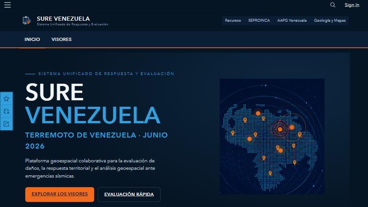
SURE Venezuela: a unified geospatial response platform for the June 2026 earthquakes
A public ArcGIS Hub site that brings damage reports, viewers and field forms together so responders and citizens work from one map.
 Featured
Spatial Analysis
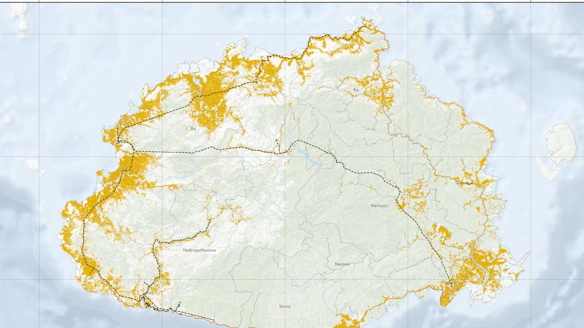
Where to build solar on Viti Levu, Fiji: a suitability model
A weighted raster model ranking 10,688 km² of Fiji's main island and finding 1,379 km² suitable for photovoltaic infrastructure.
 Featured
Remote Sensing & GEE
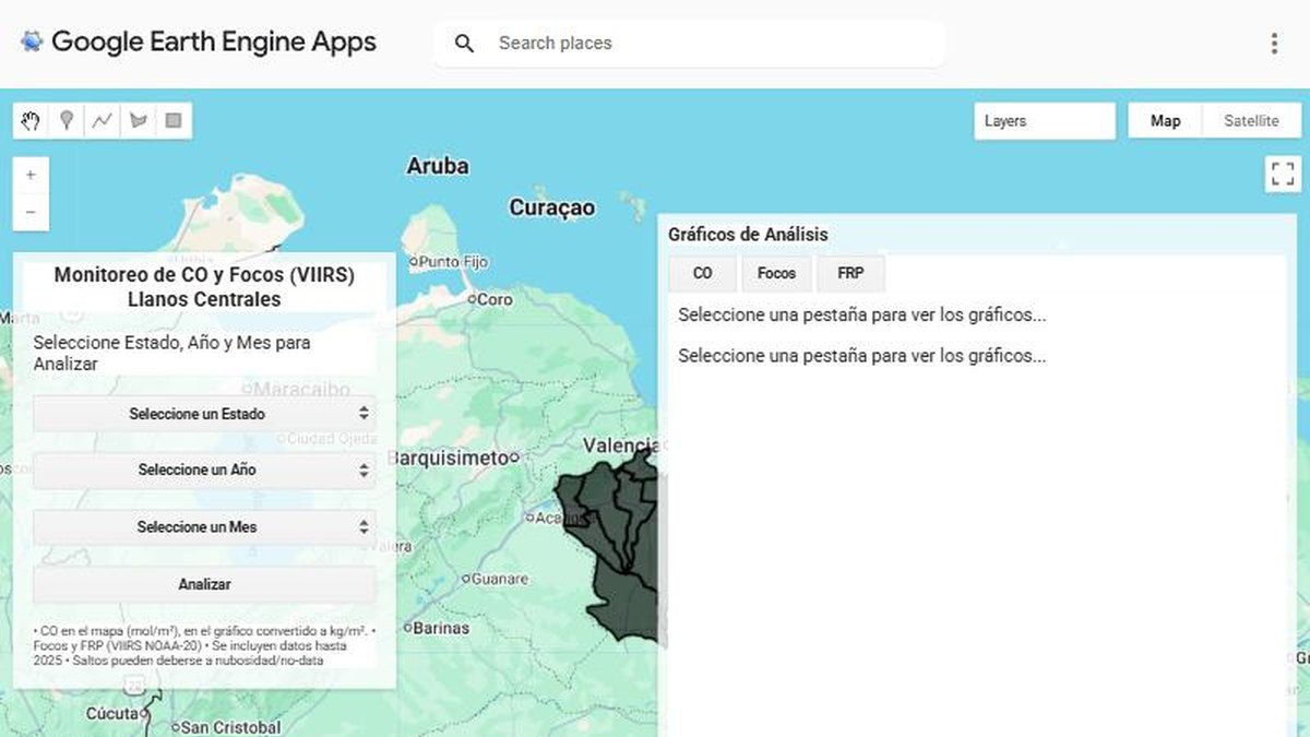
Fire monitoring app for the central Llanos with Google Earth Engine
A web app that counts fire hotspots and tracks carbon monoxide for any state, year and month, with charts generated on demand.
 Featured
Automation & Spatial Data
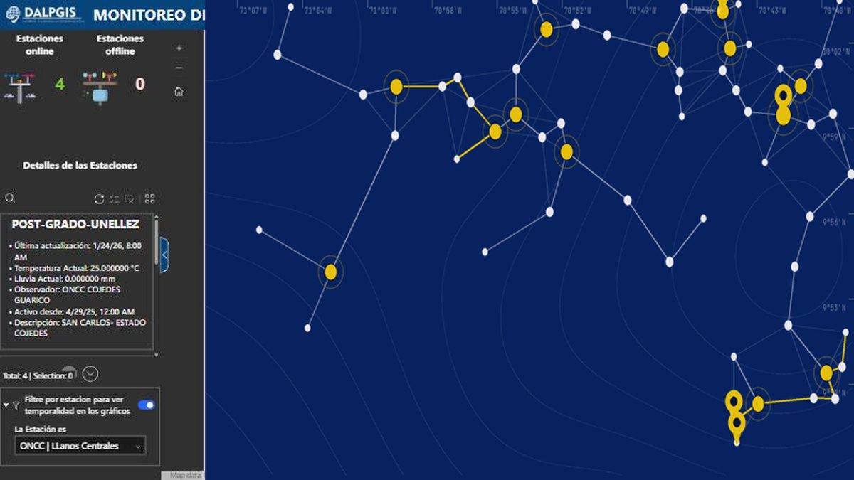
Real-time climate station monitoring with an automated ArcGIS notebook
A dashboard that shows which weather stations are online and what they measure, fed automatically by a scheduled notebook task.
 Featured
Web GIS & ArcGIS Online
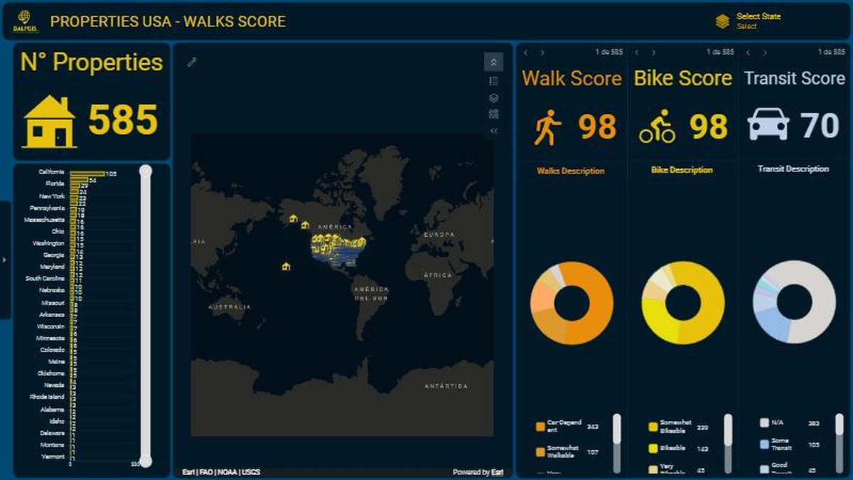
Property portfolio dashboard scored for walkability, biking and transit
An ArcGIS dashboard that turns 585 properties into a story: how walkable, bikeable and transit-friendly each location is.
 Featured
Web GIS & ArcGIS Online
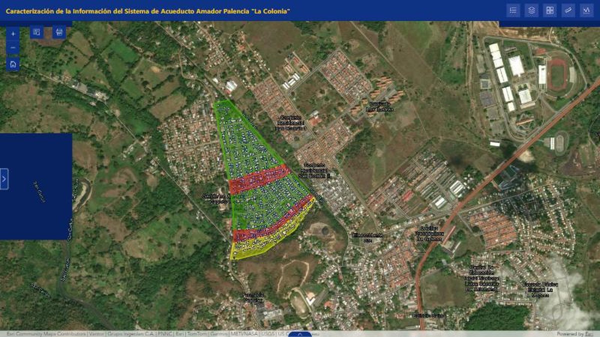
Water and sewer system viewer built with Experience Builder
An interactive viewer that characterizes a water-supply system over aerial imagery so the utility team can inspect parcels and networks.
 Featured
Cartography
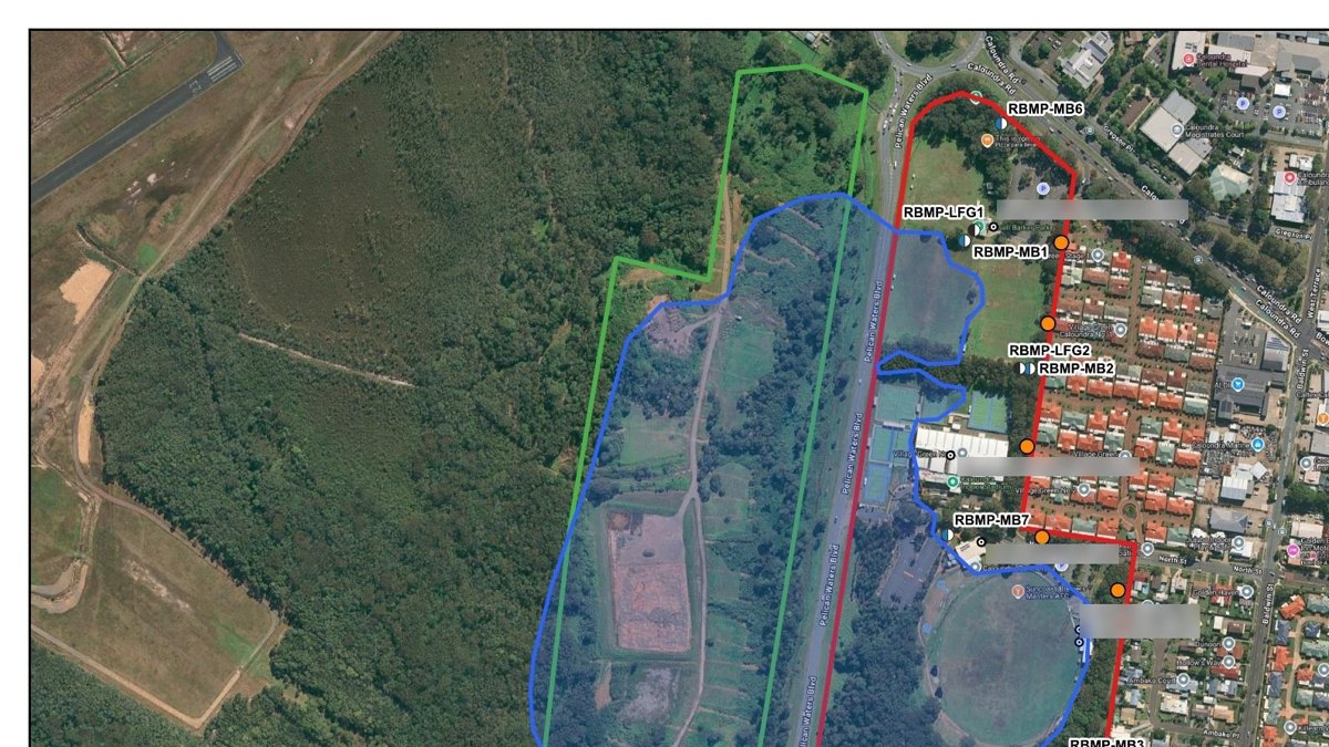
Site layout plans for landfill gas risk assessments
Print-ready A3 site plans and cross-sections showing monitoring wells, waste extents and site boundaries over aerial imagery.
 Featured
Spatial Analysis
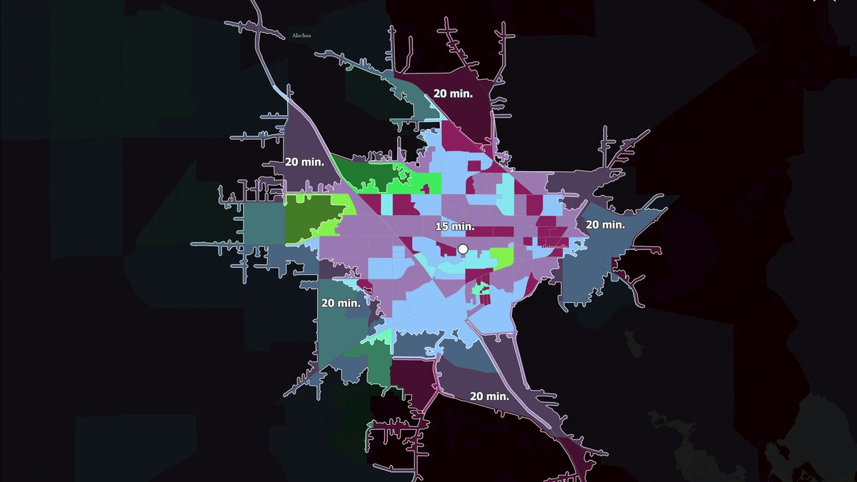
Drive-time service areas around a business location
A 5- to 30-minute service-area map that shows which neighbourhoods a site can reach and how much population lives inside each ring.
 Featured
Automation & Spatial Data
GeoPulse Inspector: find the services behind any web map
A free Chrome extension that detects ArcGIS REST, WMS and WFS services in any map viewer and exports them to QGIS.
 Featured
Geomarketing
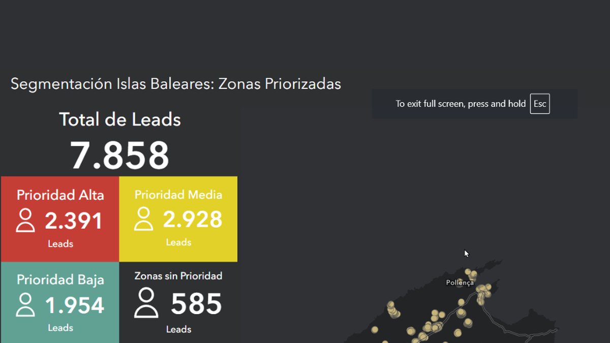
Prioritizing 7,858 leads: customer segmentation on a dashboard
A dashboard that scores sales leads by priority and shows where to focus a telemarketing campaign.
 Featured
Geomarketing
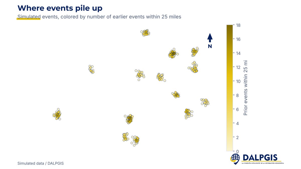
How many visits is too many? Saturation analysis for a touring business
An Excel model with an adjustable radius that counts earlier nearby events and the rest time between them, to show where a market is saturated.
Remote Sensing & GEE
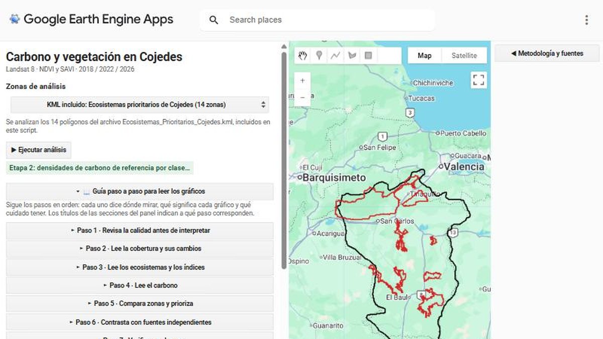
Carbon and vegetation analysis for priority ecosystems in Cojedes
A Google Earth Engine app that reads vegetation indices and carbon densities across 14 priority ecosystem zones, with a step-by-step guide.