Spatial Analysis
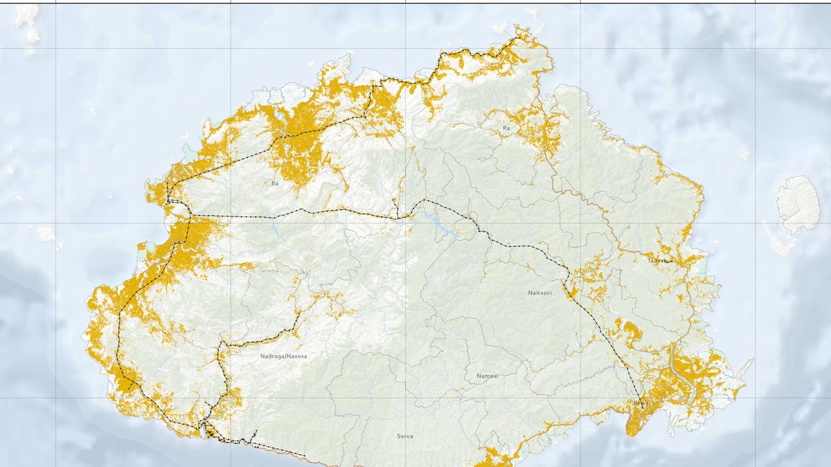
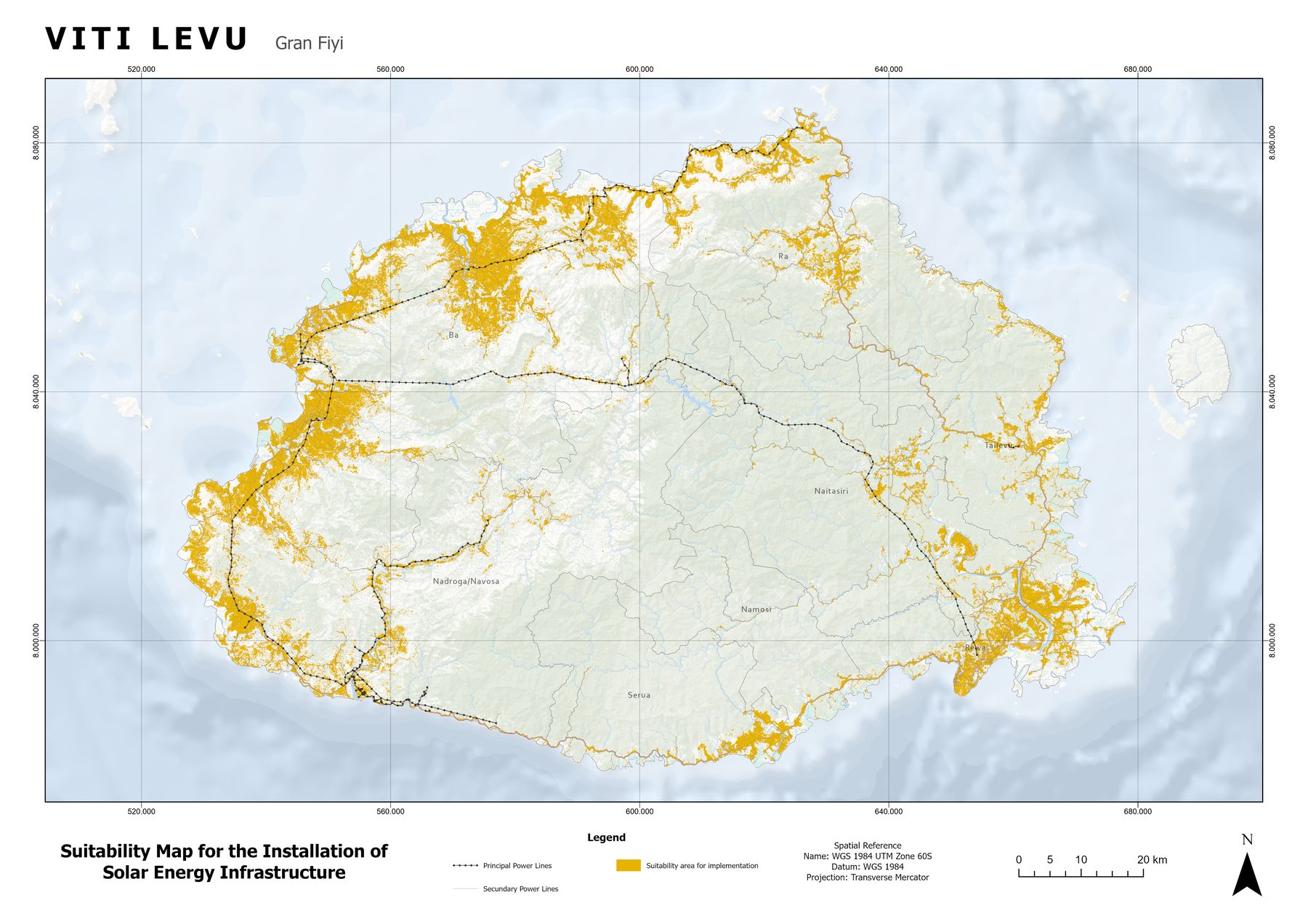
Where to build solar on Viti Levu, Fiji: a suitability model
A weighted raster model ranking 10,688 km² of Fiji's main island and finding 1,379 km² suitable for photovoltaic infrastructure.
The challenge
A developer needed to know where, on a whole island, photovoltaic plants could be built with the least risk and cost, and to hand investors a defensible, transparent method.
The solution
I combined physical, environmental and built-environment variables in a raster model. Each variable was scored from 0 to 5, exclusion zones were set to 0, and the maps were added with raster algebra. Estimated PV output (PVOUT) from the Global Solar Atlas was used as a second, independent check.
- Exclude: water, mangroves, forests, rock and flood-prone areas are removed from consideration.
- Score: land cover (Fiji Land Use Land Cover 2022, 10 m), slope (up to 20% ideal, above 60% unfeasible), distance to power lines, road access, and proximity to commercial and tourist demand.
- Validate: compare the suitability result with long-term PVOUT by province.
- Report: a summary workbook with pre-model and post-model tables per province.
Results
- 1,379 km² suitable out of 10,688 km² on Viti Levu (12.9%)
- Western division holds the most suitable land (1,025 km²), led by Ba province with 608 km² (22.5% of its area)
- Island-wide average PVOUT of about 1,285 kWh/kWp per year, with the Western division at around 1,363
Deliverables
Suitability map · Methodology report · Excel summary by province · Reproducible model
Gallery
Next step
Need something similar?
Tell me about your data and your goal. I will reply with a clear approach, timeline and quote.